Designed for both independent use and for the use as a part of shipboard navigation complexes in order to determine the geographic coordinates of the ship position and solve the service tasks of navigational support on GNSS GLONASS/GPS/SBAS/PPRNS signals with the opportunity to receive correcting information transmitted by monitoring and correcting station of medium wave sea beacons at anchorage or in motion at a rate of no more than 70 knots.
Consumer navigation equipment INTEGRATION provides reception and processing of signals from satellite radio navigation systems, their augmentation systems, pulse-phase radio-navigation systems and monitoring and correcting information of medium wave range stations.
CNE INTEGRATION solves the following tasks:
- Determination of the ship’s geodetic coordinates*
- Determination of ground speed vector (track angle, ground speed)
- Determination of time in UTC(SU) and UTC(US) scales
- Supports the satellite signals reception with elevation angles above the horizon exceeding five degrees.
- Reception and processing of PPRNS signals
- Reception, processing and consideration of correcting corrections transmitted by ground-based PPRNS stations as symbolic information
- Entry and storage of up to 1,000 routing points.
- Entry and storage in memory of up to 20 routes or fairways (up to 50 points in every route).
- The calculation (loxodrome and orthodrome) of:
- the time of the ship arrival to the point with specified coordinates at specified rate of movement;
- the distance and direction between two routing points;
- the parameters of deviation from the set route.
- Audible and visual alarm:
- about the approach to the routing point at the specified distance;
- about the departure outside the chosen width of the fairway.
* Navigation information output is in WGS-84, PZ-90, SK-42, SK-95 systems.
The CNE complies with the Rules for the Equipment of Sea-Going Ships of Russian Maritime Registry of Shipping, Rules of Russian River Register, Rules for the Technical Supervision during Construction of Ships and Manufacture of Shipboard Materials and Products, the requirements of Technical Regulations for the safety of inland water transport objects.
| The number of signals receive channels ST GLONASS/GPS |
16 |
| The number of correcting information receive channels |
3 independent parallel channels, in frequency range of 283.5-325.0 кHz |
| The number of received and processed PPRNS stations |
up to 10 |
| Errors of navigation parameters definitions: |
| In GLONASS system without differential corrections for:
— planimetric location coordinates, m, no more than
— altitude, m, no more than
— velocity, m/s, no more than |
16
20
0.05 |
| In GLONASS and GPS systems taking into consideration differential corrections for:
— planimetric location coordinates, m, no more than
— altitude, m, no more than
— velocity, m/s, no more than |
10
15
0.05 |
| Average time till the first definition, s, no more than |
| — “hot” start
— “warm” start
— “cold” start |
20
50
180 |
| Input/output ports |
RS-422 |
| Input (output) velocity in IEC 61162 message format, kbit/s |
4.8; 9.6; 38.4; 115.2 |
| Communications protocol |
IEC 61162 (NMEA 0183 V.2.3) |
| DC power supply voltage, V |
15-30 |
| AC power supply voltage frequency, V, Hz |
220±10%,50 |
| Power consumption, W, no more than |
10 |
| Working temperature, °С: |
| — INTEGRATION device
— GLONASS/GPS antenna and monitoring and correcting station and PPRNS antenna |
from -15 to 55
from -40 to 55 |
| Mass, kg, no more than: |
| — INTEGRATION device
— GLONASS/GPS and monitoring and correcting station antenna
— PPRNS antenna
— network adapter |
4.5
0.8
0.46
0.5 |
| Outline dimensions, mm: |
| — AQUA-BOARD-12 device
— GLONASS/GPS and monitoring and correcting station antenna
— PPRNS antenna
— network adapter |
321.0х205.0х71.5
160.0х160.0х130.0
774.5х109.5х74.0
35.0х75.0х115.0 |
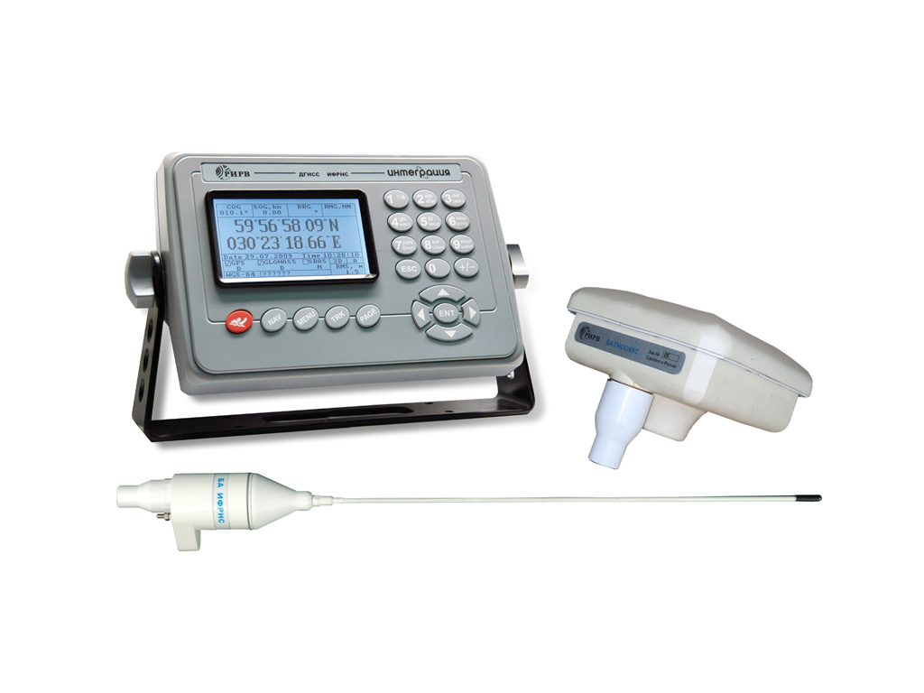
- INTEGRATION device
- GLONASS/GPS and monitoring and correcting station antenna unit
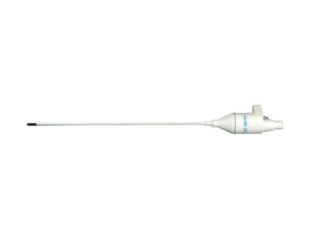
- PPRNS antenna unit
- Mounting parts set
- Network adapter
- Packaging
- Operating documentation set
Deployment on the object:
The CNE is deployed considering external influencing factors constraints when in operation.
The INTEGRATION device is deployed inside the object case in any convenient place at a distance not exceeding the length of high-frequency cable from the antenna units.
The INTEGRATION device case is secured to the bracket with two thread hold-down nuts. The bracket is secured rigidly on the object through four holes 7mm in diameter, and the setting angle of the INTEGRATION device can be regulated with thread hold-down nuts.
Cables and bundles, connected to the INTEGRATION device from consumer shipboard equipment, are secured on both sides.
The GLONASS/GPS and monitoring and correcting station antenna unit is deployed in the upper part of the ship, above the level of the deck superstructure. For securing GLONASS/GPS and monitoring and correcting station antenna unit on the object, there is a location slot on the bottom of its basement with internal thread of 1” 14UNS standard.
PPRNS antenna unit should be installed vertically and as far as possible from the devices emitting electromagnetic radiation. PPRNS antenna unit should be deployed at the distance not exceeding 3m from the GLONASS/GPS and monitoring and correcting station antenna unit.
For securing PPRNS antenna unit on the object, there is a location slot on the bottom of its basement with internal thread of 1” 14UNS standard.